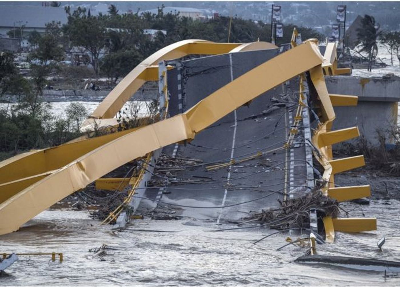
Roughly half an hour after a 7.5 quake struck the Indonesian island of Sulawesi, twenty-foot-high waves followed. While the quake registered the highest magnitude anywhere in the world this year, it was the tsunami that left destruction in its path, killing hundreds of people and destroying infrastructure and homes in the coastal town of Palu.
To understand the conundrum of this most recent tsunami, we have to dive into geology for a minute, back to middle school lessons on tectonic plates. The area where the quake and subsequent tsunami occurred is known for such events because it sits on the Sunda “megathrust” fault where the Indo-Australian plate submerges under the Eurasian plate. This vertical movement of the plates can displace a huge volume of seawater, resulting in a high-speed tsunami wave, explains The Guardian.
But the tricky thing about last week’s quake is that it wasn’t the normal thrust motion – it happened on a “strike-slip” fault, a more horizontal motion. In this case, the rock to the east of the fault running up through the island moved northwards relative to the rock to the west, reports BBC News. Such a motion does not usually result in a tsunami because not much water is displaced. Knowing this, scientists have been trying to figure out what caused the tsunami.
One theory is that the earthquake resulted in an underwater landslide, which itself displaced sufficient water to trigger a tsunami wave. Another option is if the quake occurred along an inclined area of the seafloor; were this the case, the horizontal motion from the strike-slip could have pushed seawater in front of the slope, thus creating the verticality needed for the tsunami. Additionally, the narrow shape of Palu bay likely came into play as well, because the waves were able to grow in size as their area was restricted.
"My first calculations of the seafloor deformation in the earthquake are 49cm," said Dr. Mohammad Heidarzadeh, an assistant professor of civil engineering specializing in coastal engineering at Brunel University in the UK. "From that, you might expect a tsunami of less than one meter, not six meters. So, something else is happening. So, the two speculations are legitimate - the submarine landslide and the funneling caused by the bay."
Scientists are still working on determining the generation and propagation processes involved in causing the huge waves using modeling and bathymetric surveying, as well as satellite imagery to assess for on-land landslides. In the meantime, humanitarian aid is rushing to the region to give as much help as possible to the victims of these natural disasters. Meanwhile, just hours ago, Mount Soputan erupted on the already stricken island.
Sources: BBC News, The Guardian