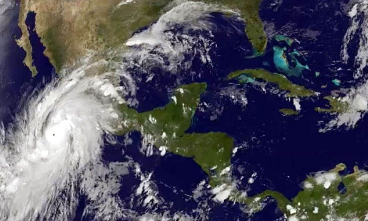
Hurricane Patricia, which is proving to be one of the strongest hurricanes ever recorded in the Western Hemisphere, appears to be making its way to Mexico’s central Pacific Coast. Just two days ago, this modest hurricane wasn’t summing up to be an issue but since then, it has transformed into a Category 5 storm.
The officials have declared a state of emergency and have been handing out sandbags in preparation for flooding as steady rain began to fall in the area around the port of Manzanillo ahead of an expected landfall. The Mexican government has even went as far as scrambling to evacuate thousands of people in the states of Colima, Nayarit and Jalisco.
Not only has Hurricane Patricia been recorded as the move powerful hurricane but also as one of the fastest growing on record. Roughly 24 hours ago, the winds were clocking in at around 130 mph. More recently, the winds have sped up to 200 mph, which are comparable to the strongest tornadoes.
According to meteorologist, Jeff Masters, of Weather Underground:
The wind damage is going to be something extraordinary. We’re talking like a high end EF4, low end EF5 tornado that’s 15 miles wide hitting the coast, if it stays at this strength.
So how exactly does a hurricane that was labeled as “moderate” turn into the monster that is turning out to be? There are three primary factors at play here:
The Temperature of the Oceans Water
The water in the Eastern Pacific is currently sitting at more than 30 degrees celcius. This number is roughly one degree higher than what is normally seen at this time of the year. Though that doesn’t sound alarming at first, even a difference of 1-2 degrees can help to pump up the energy of a hurricane.
The Atmospheric Winds
Generally speaking, the speed of atmospheric winds, which are classified as wind that isn’t part of a hurricane, moves across the upper reaches of the storm formation in a slow manner. If the wind there is high, it can help to divert the hurricane or alternatively, shear it apart. Unfortunately, for the last few days, the winds along the coast of Mexico have been unusually calm, which in this case, ended up helping the hurricane get stronger.
The Humidity
A hurricane needs moist air to help feed it and grow stronger. The environment on Mexico’s coast, which was sitting at roughly 80% humidity, played a strong role in helping the hurricane gain momentum.
These three factors combined have played the perfect role to help build a hurricane that the Mexican National Weather Service appears to be calling “the most dangerous storm in history.”
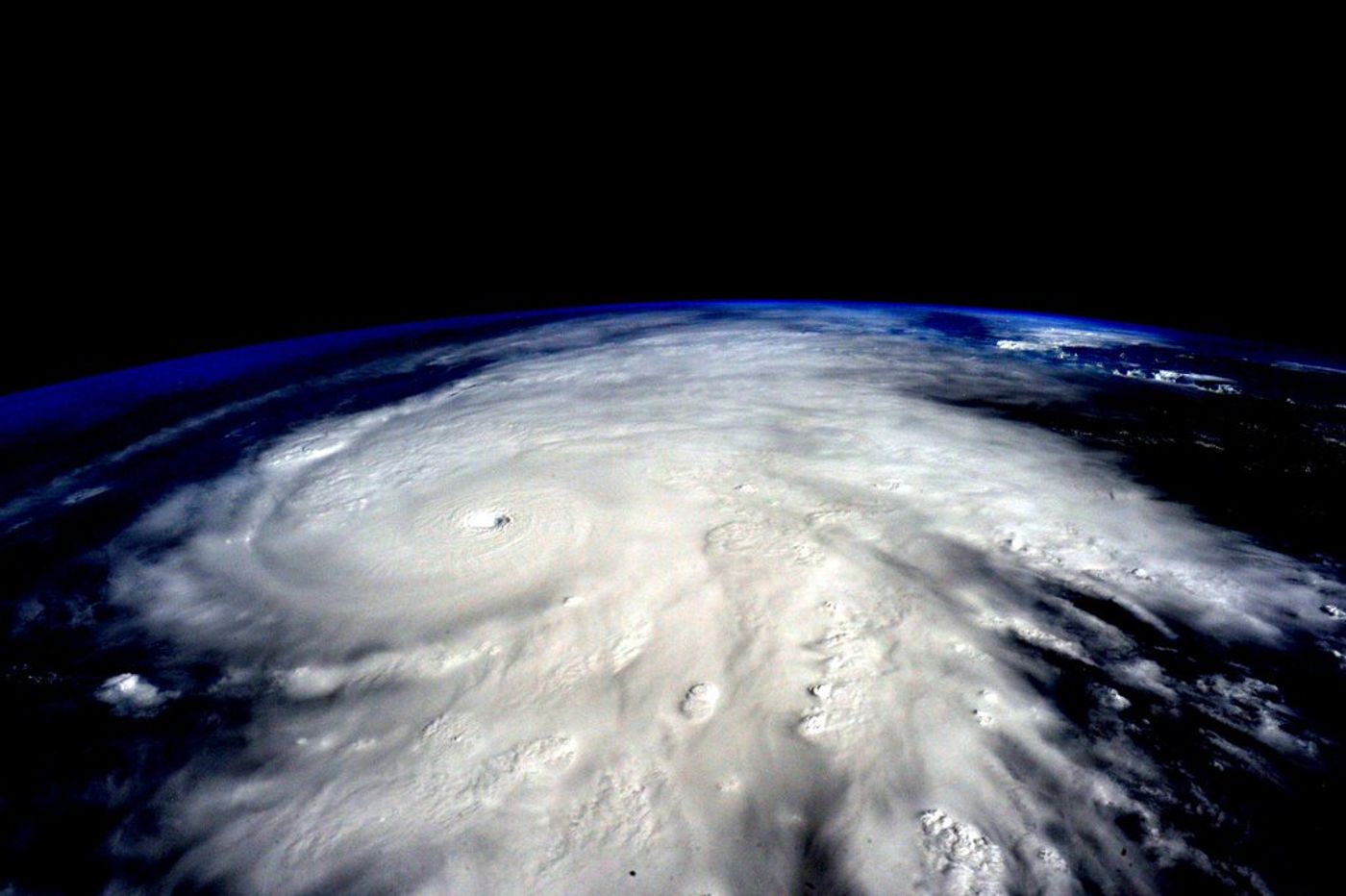
As the saying usually goes, a picture says a thousand words. In this case, NASA astronaut Scott Kelly tweeted photos of Hurricane Patricia from outer space, which you can see below:
You can also watch footage of Hurricane Patricia from the International Space Stations point of view:
Source:
LA Times,
Scientific American, Twitter (
Scott Kelly)