Can we use artificial intelligence (AI) to monitor environmental sites using remote sensing images, either from satellite or drones? This is what a recent study published in Remote Sensing of Environment hopes to address as a team of researchers examined how coral reef halos, also called sand halos and grazing halos, can now be monitored from space using newly-created deep learning algorithms, which is a type of AI.
The researchers hailed from the School of Ocean and Earth Science and Technology (SOEST), and this study holds the potential to help scientists use AI as a conservation tool for identifying and tracking the formation and evolution of coral reef halos, which are often the result of herbivore and predator populations feeding on the coral reefs.
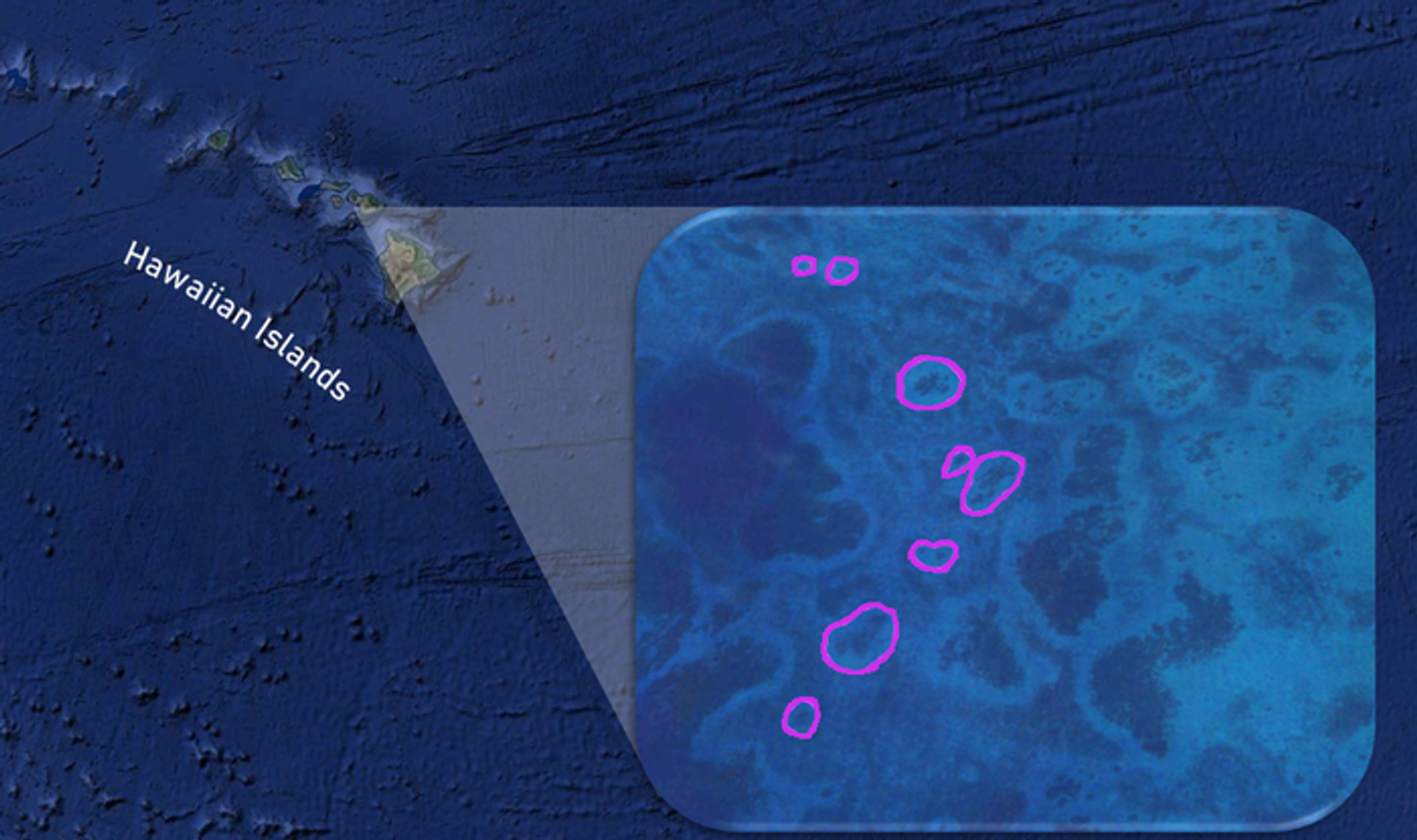
Salellite image of coral reef halos in the Hawaiian Islands. (Credit: Elizabeth Madin Lab)
“Reef halos may be important indicators of the health and vitality of coral reefs, but until now, their measurement and tracking has been a challenging and time-consuming process,” said Dr. Simone Franceschini, who is a postdoctoral research fellow in the Madin Lab at the Hawai‘i Institute of Marine Biology (HIMB) in SOEST, and lead author of the study. “However, with this new method, we can accurately identify and measure reef halos on a global scale in a tiny fraction of the time it would take a human being to accomplish the same task.”
For the study, the researchers used SkySat satellite images from the Planet Inc. Planet Explorer Catalog to examine 20 areas of interest (AOI) across six countries: Belize: 7, Bahamas: 6, Egypt: 3, Saudi Arabia: 2, USA (Florida): 1, and Australia: 1, with a total number of 3,322 reef halos observed. Each satellite image was approximately 20 km (12.4 mi) x 5.9 km (3.7 mi) with spatial resolution—which is the measurement of the smallest object that can be imaged by the camera senso—between 0.5 m (1.6 ft) and 0.8 m (2.6 ft).
The researchers then used a deep learning method known as a convolutional neural network (CNN) to analyze the images and were successful in both identifying and measuring changes in halo reefs around the globe.
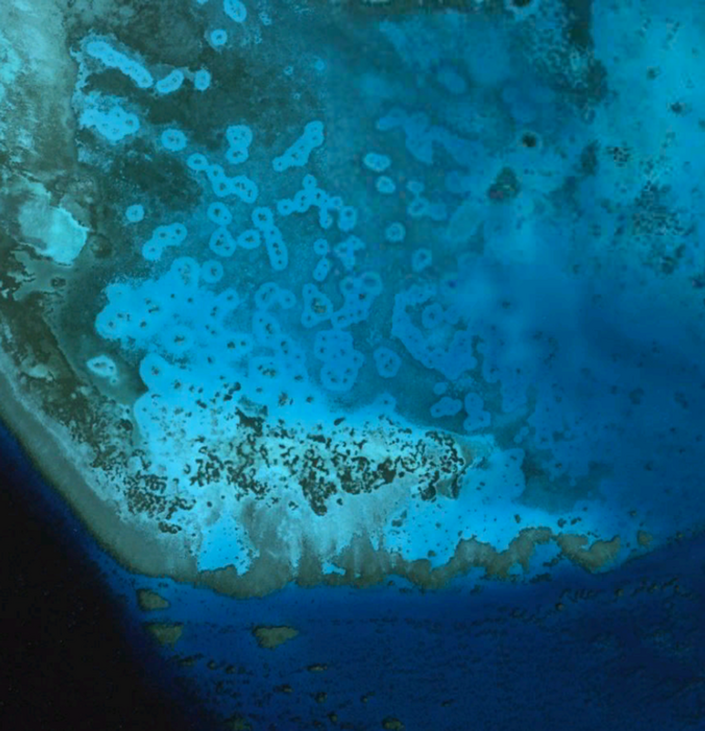
Satellite image of coral reef halos in the Red Sea. (Copyright: CNES/Airbus; DigitalGlobe)
“Reef halos are sometimes very clear in satellite imagery, with distinct edges and high contrast with background vegetation, but sometimes they are quite faint and hard to distinguish – even by a highly trained observer,” said Dr. Franceschini. “In the end, our team was able to develop a set of algorithms capable of taking into account the diversity of these patterns globally and identify and measure halos with surprising accuracy. It is hugely satisfying for us to now have built something that can accurately identify more than 90% of halos in some parts of the world.”
Going forward, the team hopes to expand the sharable scope of the data using an open-source web app that will allow scientists, resource managers, and conservation practitioners to actively monitor reef health using remote imagery, either from satellites or drones.
Sources: Remote Sensing of Environment, CBC, University of Hawai’I at Manoa, Planet Inc.
As always, keep doing science & keep looking up!