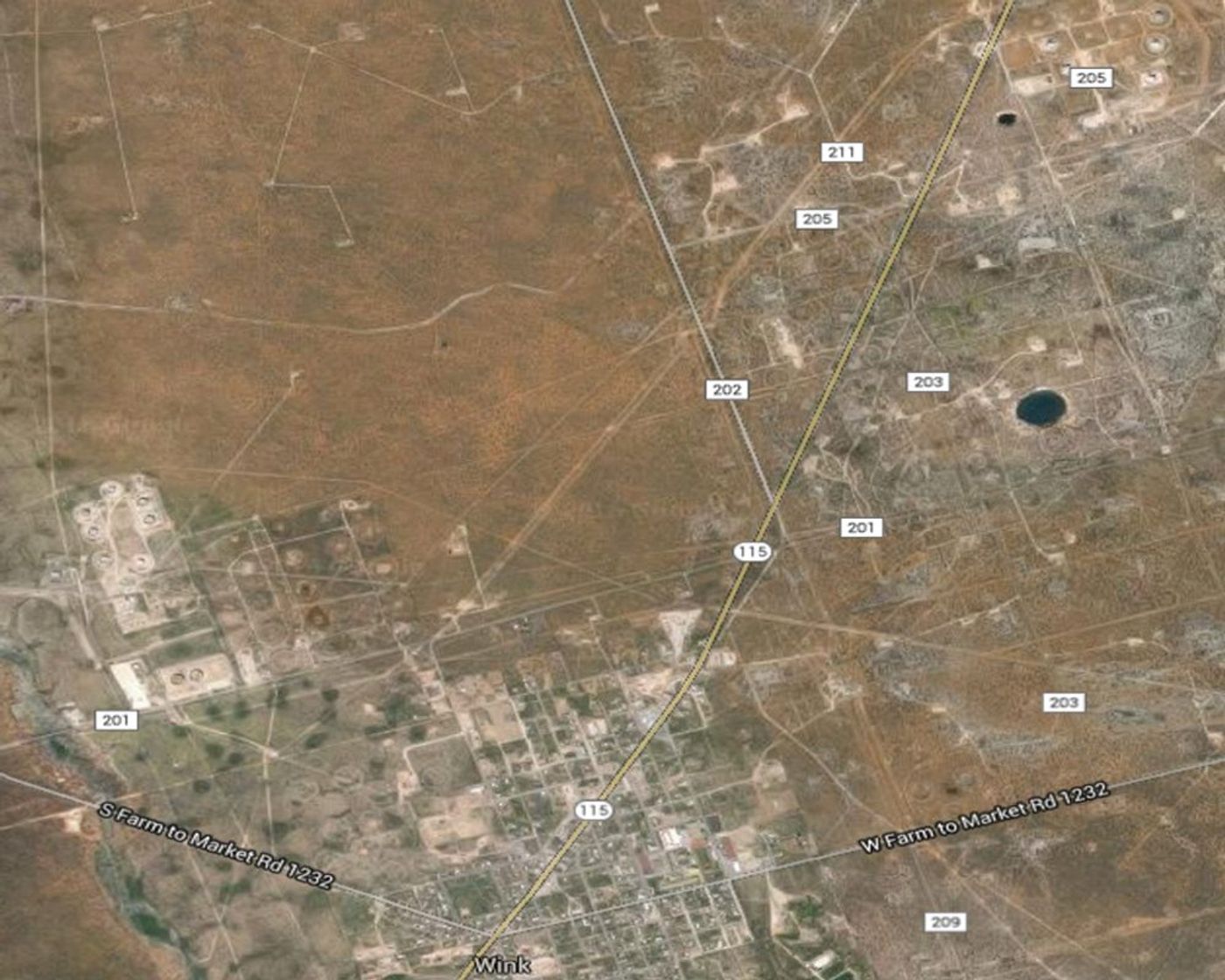
The earth is falling into itself between the towns of Wink and Kermit in Western Texas, where two sinkholes which sit about a mile apart from each other have been found to be expanding, according to scientists from Southern Methodist University.
There’s concern that the land is collapsing from years of drilling for oil and gas which peaked from 1926 to 1964. This drilling washed away salt beds under the ground, resulting in the fissures. Wink Sink No. 1, near the Hendricks oil well 10-A, opened in 1980. Wink Sink No. 2, near Gulf WS-8 supply well, opened 22 years later in 2002. In addition to drilling, the area suffers from a shifting water table, which, according to satellite readings, has resulted significant sinkage - the ground is sinking up to five inches a year.
Currently, one of the sinkholes is 361 feet across, which is approximately the size of a football field; the other is larger, 670 to 900 feet across. Geophysicist Jin-Woo Kim, who leads the SMU geophysical team reporting the findings, which they published in the journal Remote Sensing, says, “This area is heavily populated with oil and gas production equipment and installations, hazardous liquid pipelines, as well as two communities. The intrusion of freshwater to underground can dissolve the interbedded salt layers and accelerate the sinkhole collapse. A collapse could be catastrophic.”
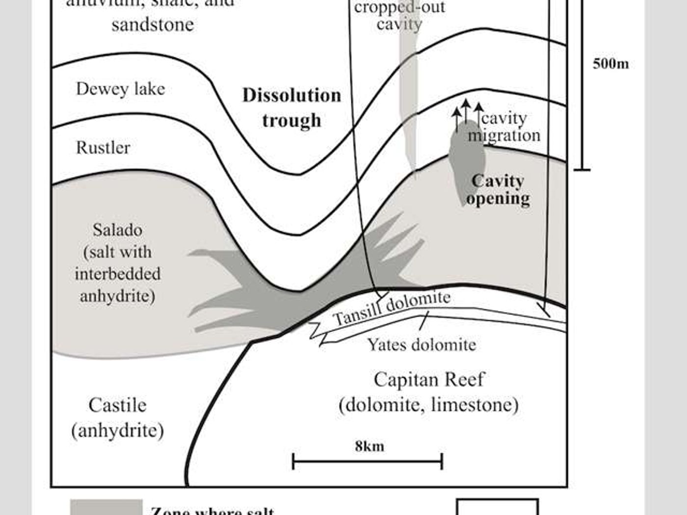
According to the SMU Research blog, the area’s unstable ground is related to changing groundwater levels and dissolving minerals. The scientists say that a deep-seated salt bed underlies the area, which is a part of the massive oil-rich Permian Basin of West Texas and southeastern New Mexico. The SMU geophysicists found a high correlation between groundwater level in the underlying aquifer and further sinking of the surface area during the summer months, influenced by successive roof failures in underlying cavities.
“It's pretty scary. It's just a big huge pit,” said Winkler County Sheriff George Keely, who has peered over the edge many times in his career. “It's like standing on the moon looking into a crater. And you can see where it's just caved off. It’s broken off over the years more and more. When you look down there, you're looking at water.”
Sources:
SMU Research,
WBUR,
Midland Reporter-Telegram