
Neuroscience
Stabilized Receptor Helps to Solve Brain Signaling Mystery
JAN 17, 2014 12:00 AM PST
Share
New Project Attempts to Combine Useful Climate Data
 With today's concerns about climate change and the massive amount of research emphasis in the field, data collection of global surface temperatures is increasingly important. Accurate land surface temperatures help to provide better models for such things as atmospheric convection processes and evapotranspiration processes (the collective transfer of water to the atmosphere from the ground, from plants, and from bodies of water). This data can be analyzed in a variety of useful ways-if it's complete and reliable.
Many climatologists and meteorologists use classic technology (thermometers on earthbound weather stations) to record air temperatures near the surface. If what you are interested in is the surface temperature, the nearby air temperature is not necessarily the best correlation-as anyone who has walked barefoot across an asphalt parking lot in the summertime will tell you.
Correlations from air temperatures work to a certain extent, but they aren't as useful for drawing broad conclusions over large surface areas. Plus, if you want to gather data in sparsely populated areas-the Sahara Desert or the middle of the Atlantic Ocean, for example-you may have to draw straws to see who is the lucky person that gathers those readings. Satellite data is a preferable alternative, as it's more efficient (and less dangerous) to gather.
There are already many satellites roaming the skies, collecting data and transmitting it to various agencies. However, this data has limitations. For example, cloudy conditions may prevent gathering data, or make the data of questionable quality. This could be partially overcome by collecting all the data from overlapping sources as a double-checking mechanism, except that there is no single format used for all of the data transmissions.
The European Space Agency (ESA) is attempting to deal with this problem through their GlobTemperature project. ESA intends to combine data from multiple satellite sources using a common format, and store this data in an online archive for climatologists to use. Satellite sources to be combined include the European MSG-3 satellite and ESA's Met-Op and Sentinel-3 satellites, as well as Japanese and American sources. Archived data will also be included to provide a reference.
To convince potential users of the benefits of satellite-based land temperature surface data, there are case studies underway in five diverse areas to demonstrate the positive effects. Of the five current test sites, three of them are directed at using the satellite data to more accurately predict rates of evapotranspiration in three different continents (Africa, Europe and North America). The hope is that the data can be used for projects ranging from assessment of droughts in relatively inaccessible areas to predicting crop yields of various agricultural products.
A further goal of the project is to better understand the correlation between the Earth's surface temperatures and the surrounding levels of air. If this correlation can be strengthened, the GlobTemperature project data could be merged with historical air temperature data to produce a powerful database spanning many years worth of valuable information. Increasing the collective database in this manner could be an important step forward in a more accurate prediction of the effects of global climate change.

Bachelor's (BA/BS/Other)
You May Also Like
OCT 28, 2025
Earth & The Environment

How can AI be used to predict ocean forecasting? This is what a recent study published in the Journal of Geophysical Res
...
DEC 05, 2025
Technology

How can seashell waste be used in construction? This is what a recent study published in Construction Materials hopes to
...
DEC 10, 2025
Earth & The Environment

How can climate change impact sleep patterns? This is what a recent study published in Environmental International hopes
...
DEC 10, 2025
Earth & The Environment
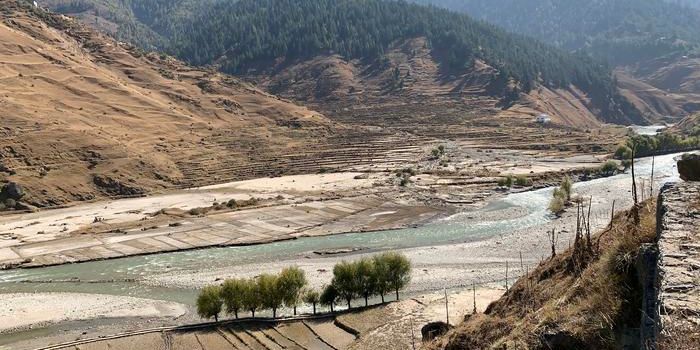
How can climate change impact flood risks for the Himalayan floodplain, which is a globally known flood region? This is
...
DEC 12, 2025
Technology
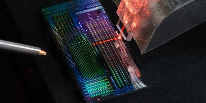
How can a computer chip the size of a human hair enhance the future of quantum computing? This is what a recent study pu
...
JAN 08, 2026
Earth & The Environment
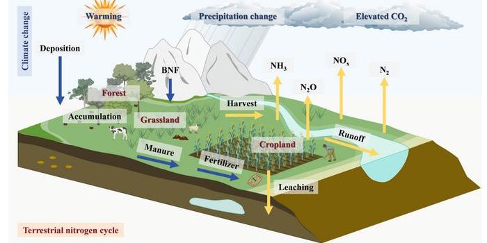
How does climate change influence the planet’s nitrogen cycle? This is what a recent study published in Nitrogen C
...
Loading Comments...