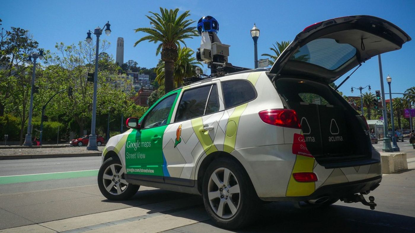
In an effort to better understand pockets of urban air pollution in California’s West Oakland, Google Street View cars have been equipped with special “mobile labs” from a San Francisco startup called Aclima.
Aclima’s mobile platforms were set up inside Hyundai Santa Fes in order to take advantage of the street view cars’ intricate GPS tracking system and 360-degree cameras. The cars then sampled air through an inlet on top of the car which pumped air into a pollution-monitoring system. These systems are able to detect and monitor all sorts of compounds that may be creating air pollution, such as black carbon, nitric oxide, and nitrogen dioxide. Once the systems take the data, the information for every specific street corner and block is stored on the Google Cloud Platform which is available to the public on Google Maps and Google Earth.
The unique aspect of this project is that the street view cars make mapping specific areas of the city more possible than ever before. “We visited each block on between 20 and 50 different days over the course of a year,” says Joshua Apte, an engineering professor at the University of Texas at Austin. Such vast data sets provide more information on the “big picture” of air pollution for the city. “If pollution spikes for an instant, it may or may not be such a bad thing. But if pollution is consistently high, that’s something we really should care about."
Once the information is uploaded, anyone is able to go in and access data to see how air pollution levels change from one block to another. Currently, the project is one of the largest and highest definition data sets of urban air pollution ever. “The goal is to make this data available to more groups,” says Karin Tuxen-Bettman, program manager for Google Earth Outreach. “To put it in the hands of more people and make the invisible visible.”
Indeed, the interactive maps are already informing members of the community about the air they breathe. Erin Cary, Director of Advancement for a community garden in the neighborhood, mused: “We’ve known that there are air quality problems, but we hadn’t seen it on such a microscopic level,” she says. “The air quality in this community garden is different than down by the playground, but you wouldn’t have any sense of that without those sorts of mapping tools.”
Additionally, environmental scientists will be able to use the collected data and mobile monitoring system as a case study in order to apply the method to cities globally. Eventually, such technology may even make its way onto public buses and other public transport.
Sources: Google, CBS, Mashable, Curbed