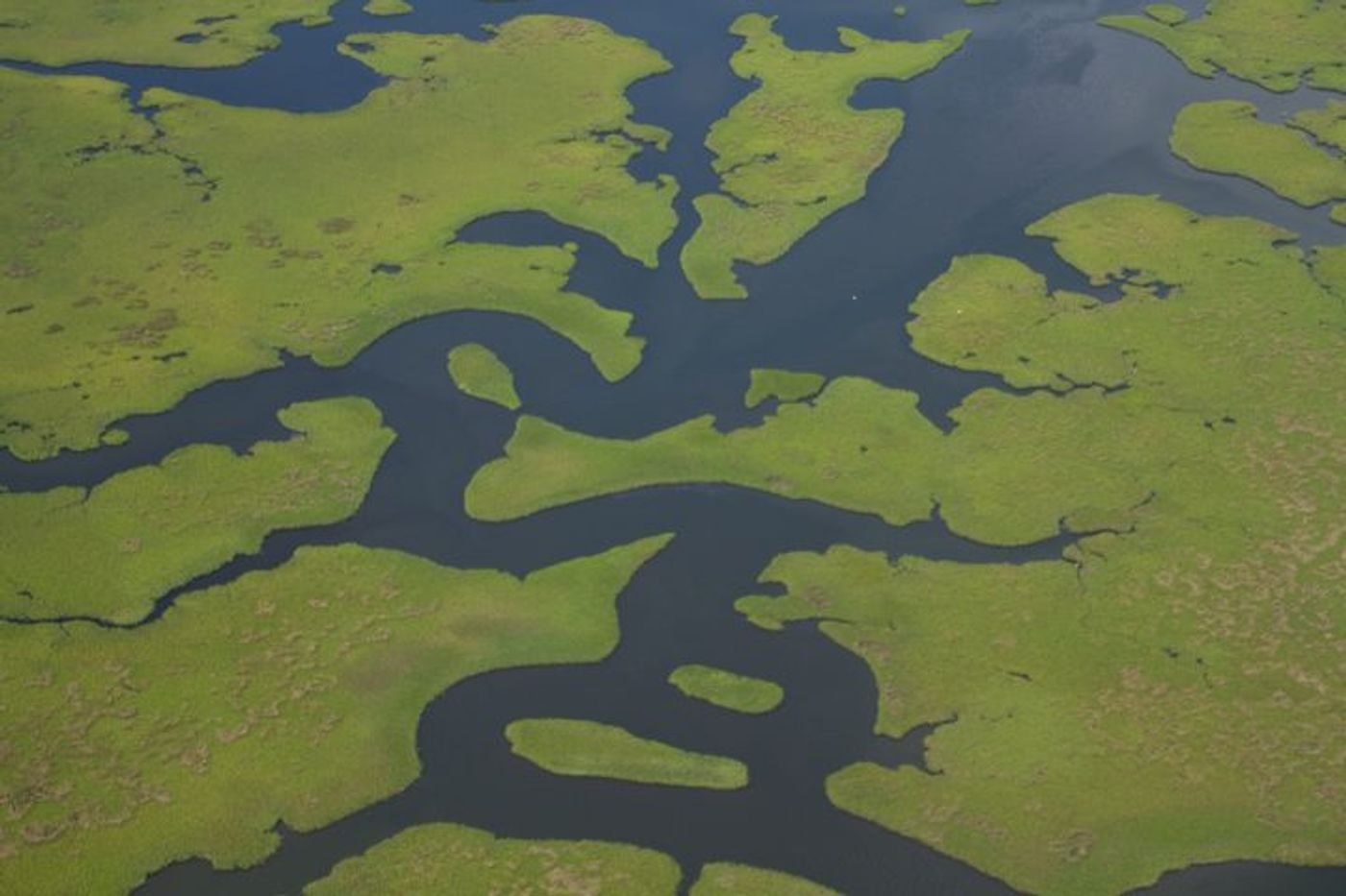
A new study published in Marine Geology poses the question: is the Mississippi slipping out from under us? The study, which comes from San Diego State University scientist Jillian Maloney and her colleagues, suggests that the seafloor under the Mississippi River Delta running to the Gulf of Mexico may be under threat of erosion. This erosion was otherwise previously undocumented because it is not as visible as eroding superficial lands. Now, though, the scientists have provided a wide-ranging map that shows just how much unseen erosion has taken place under this great river on its journey to the sea.
"Imagine this as an underwater extension of land loss that we see at the surface. This is a big deal because it can affect so many processes that occur from the coast to the open ocean including marine organisms' lifecycles and underwater landslides," said lead author Maloney.
Indeed, the team explains, land loss has huge impacts on entire ecosystems because the physical and geological changes impact biological life. When sediments build up in a riverbed to form wetlands, for example, whole new worlds are created for species to inhabit. But when those wetlands are eroded because the sediments are literally swept out from under the earth, not only does that habitat disappear with all the life that depended on it, but hurricanes and tidal floods hit harder without that physical barrier, pollution is absorbed into the waterway instead of filtered and broken down, and even human-made infrastructure is affected.
The authors note that this effect is happening with the Mississippi River Delta in large part because of all the dams that block the flow of sediments. In addition, levees that are used for the intent of flood protection also contribute to land loss. Because both dams and levees essentially break up the river, sediment flow is halted - previous studies have estimated that roughly 210 million tons of sediment are impeded from their natural flow.
In order generate their map, Maloney’s team analyzed data from various sources, including old nautical charts, previous NOAA maps, and the oil and gas industry, among others. "From this comprehensive study, we've determined that the Mississippi River Delta has entered a stage of decline. The outlets of the Mississippi River also known as the Bird's Foot Delta have been prograding, or spreading, naturally for hundreds of years, but that has now stopped. The underwater portions of the delta are now retreating like the land loss occurring in our landscape," said study co-author Sam Bentley.
The scientists doubt that the Mississippi River Delta is the only large river system experiencing this extensive erosion due to loss of sediment flow. "Given the similarities between the Mississippi River Delta and river systems worldwide, we expect other major delta systems are entering decline. This has implications for delta ecosystems and biological, geological and chemical processes worldwide," Bentley said. The Mekong River Delta, the world’s third largest delta, is also facing erosion due to human activities, and scientists are rightfully concerned over what may be the future of these important ecosystems that support so much life.
Sources: Science Daily, Marine Geology, Nature