New satellites are always being launched into space; in fact, most of the time when you see rockets being launched into space, they’re sending some kind of satellite payload far enough into space that it can orbit the planet; otherwise, they’re probably resupplying the International Space Station.
In November of last year, a rocket launched from Cape Canaveral Florida carrying the GOES-16 weather satellite, which was the result of a collaboration between NASA and NOAA. It carries the Advanced Baseline Imager (ABI) instrument that allows it to see the world more clearly than we ever have, which is particularly important for tracking weather patterns, and NASA has just recently released some of its extraordinary Earth imagery:

Image Credit: GOES-16/NASA/NOAA
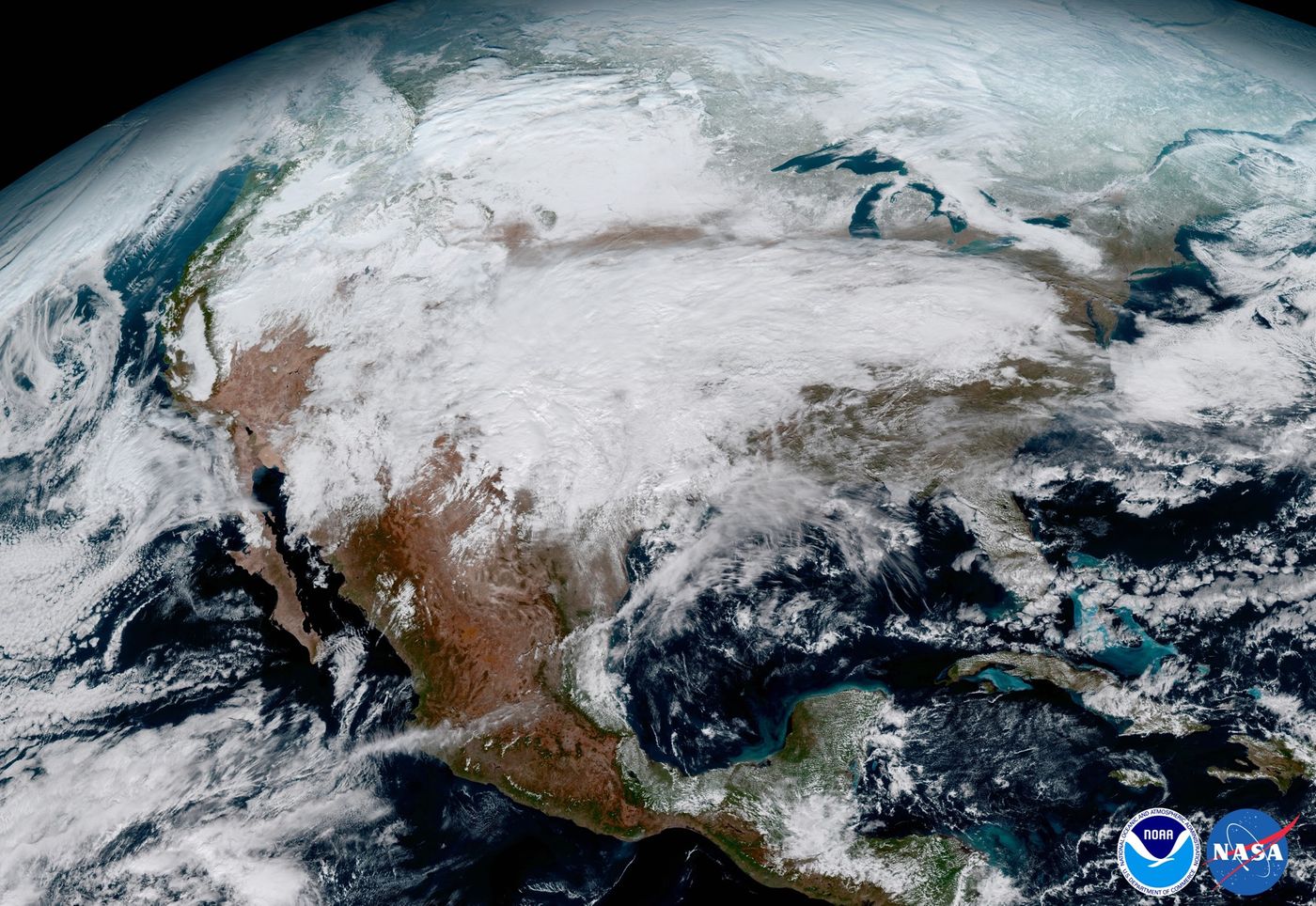
Image Credit: GOES-16/NASA/NOAA
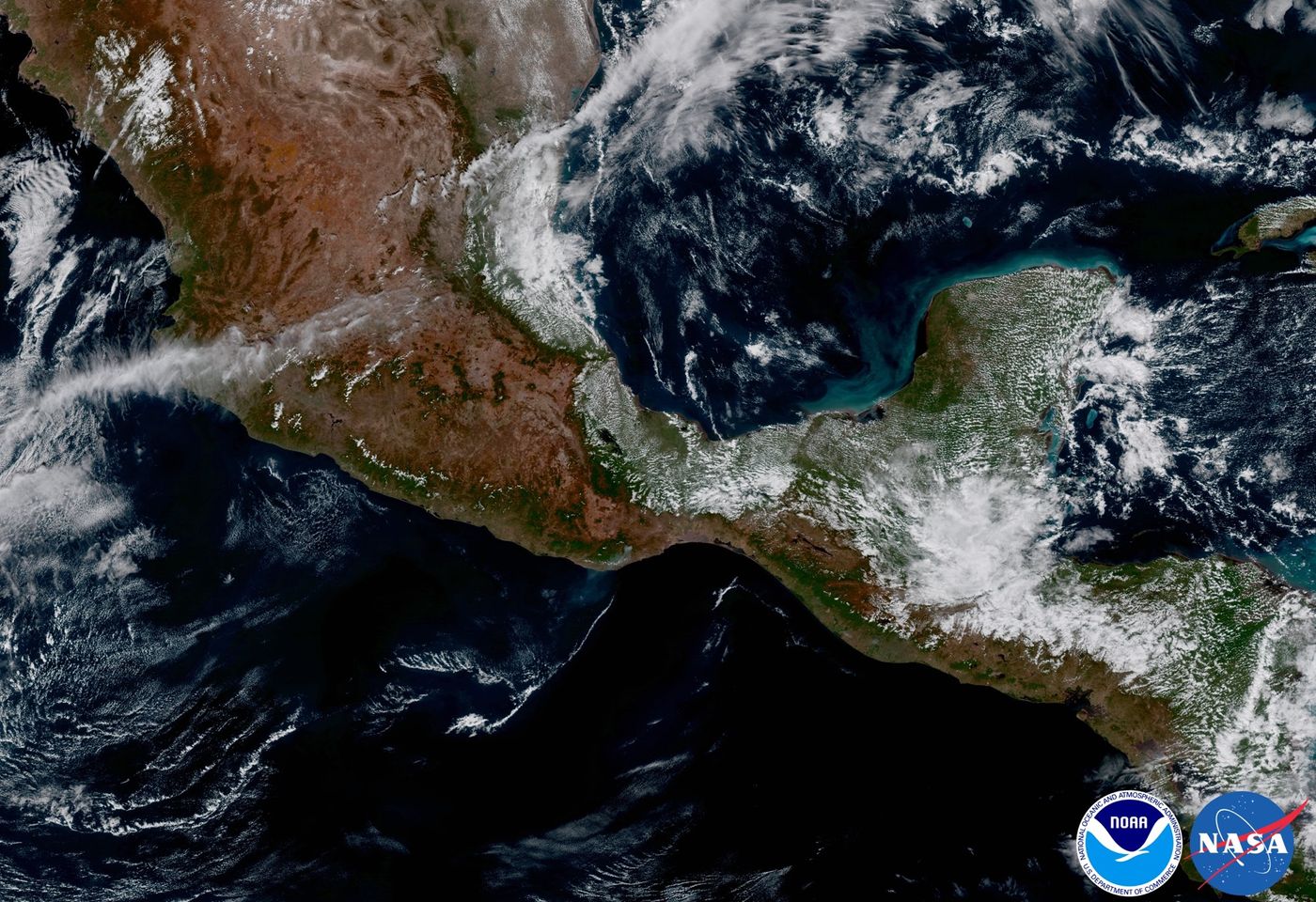
Image Credit: GOES-16/NASA/NOAA
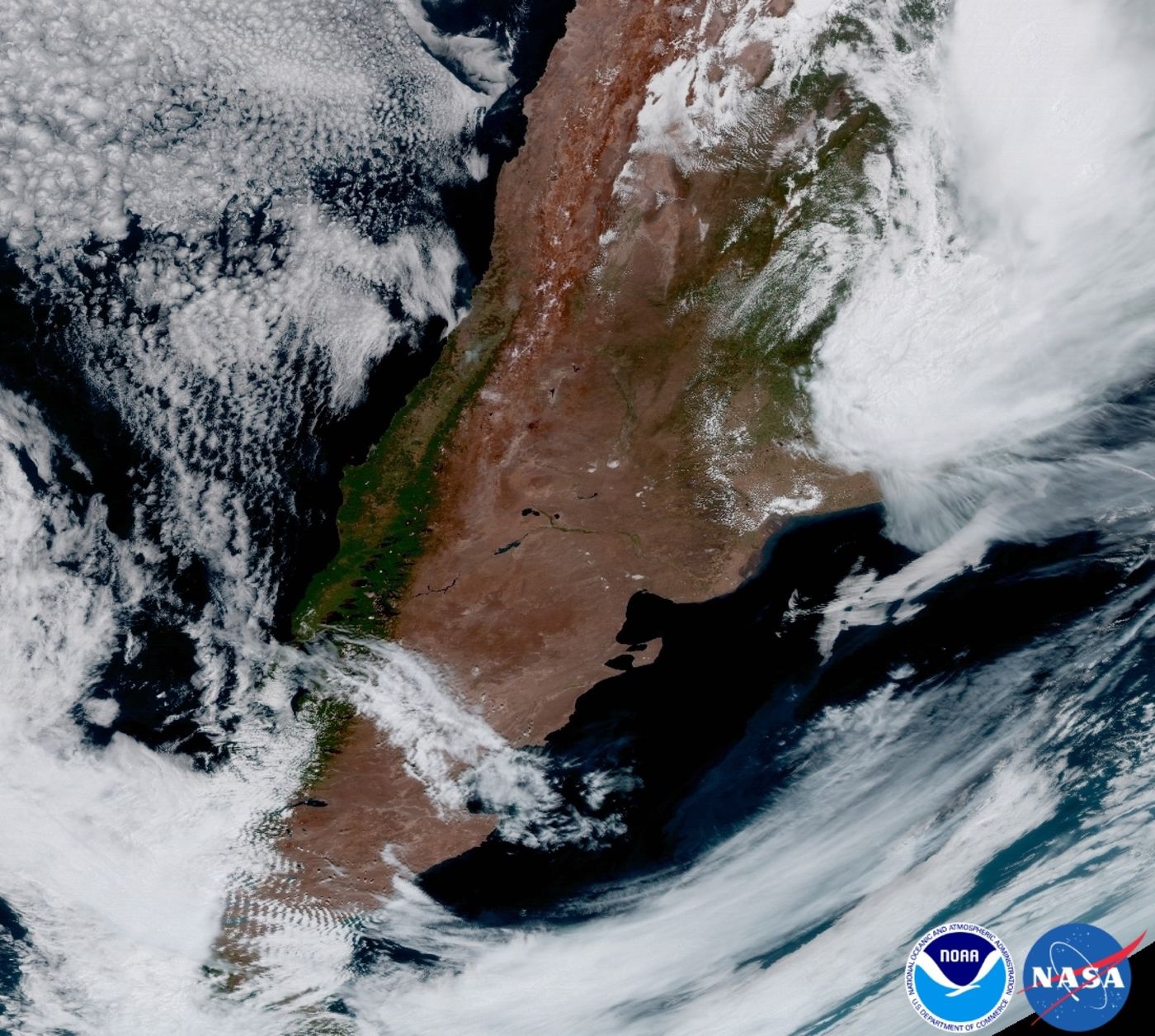
Image Credit: GOES-16/NASA/NOAA
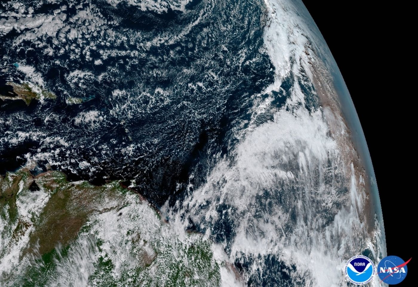
Image Credit: GOES-16/NASA/NOAA
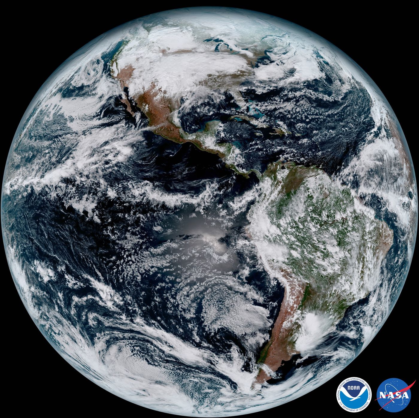
Image Credit: GOES-16/NASA/NOAA
What stands out the most is the extremely vivid detail. The ultra-high definition photographs look so crisp that you’d think they were computer-generated renditions. Of course, that’s not really the case.
“Seeing these first images from GOES-16 is a foundational moment for the team of scientists and engineers who worked to bring the satellite to launch and are now poised to explore new weather forecasting possibilities with this data and imagery,” said Stephen Volz, Ph.D., NOAA’s Assistant Administrator for Satellite and Information Services.
“The incredibly sharp images are everything we hoped for based on our tests before launch. We look forward to exploiting these new images, along with our partners in the meteorology community, to make the most of this fantastic new satellite.”
GOES-16 is also a newer model of a satellite that has existed in space since 2006, known as GOES-13, so NASA and NOAA included the following image to show a before and after image between the two, just so you can see how the color really brings the images alive:
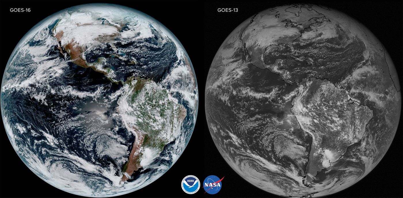
Image Credit: GOES-16/NASA/NOAA
This impressive demonstration not only proves that space technology is evolving exponentially, but also provides our administrations with better data that can be used for meteorology and weather forecasting.
While these are impressive, the NOAA shares in a press release that these are a series of satellite and that more are coming. GOES-S and GOES-17 are two more that are coming to an outer space near you. GOES-S is the next one expected to launch, and will do so in the Spring of 2018.
Source: NOAA (press release), (statement)