The Amazon River Basin, which contains 20% of the world’s freshwater and covers more than 6.1 million square kilometers, is being threatened by hydroelectric dams. Already 140 have been built or are under construction and another 428 are planned. While most dams are looked upon favorably by governments as a source of renewable energy, a team of international scientists recently published a study arguing that the environmental impact assessments being carried out for the existing and planned dams are not sufficient because they only look at the dams in isolation, instead of treating the rivers as a complex system.
“Such a local approach generally ignores the far larger, basin-scale, geomorphological, ecological and political dimensions that will determine the future productive and environmental condition of the river system as a whole,” writes the study.
The study focused particularly on how dams disrupt the flow of sediments that are so crucial to the biodiversity that the rivers create.“[The sediment is] how the rivers work, how they move, how they regenerate new land, and how they keep refreshing the ecosystems," said Professor Latrubesse, a researcher from the University of Texas at Austin. Sediments hold critical nutrients for wildlife in the Amazon's wetlands and also affects the physical geography of the rivers and floodplains. "The problem is nobody is assessing the whole package: the cascade of effects the dams produce on the whole system."
It is also necessary to take into consideration the different types of sediment, says the team. The study writes that sediment regimes and geochemistry of Amazon tributaries differ according to the dominant geotectonic regions that they drain; for example, there are Andean sediments, cratonic sediments, and sediments from foreland tropical regions. In order to get a complete understanding of how specific rivers and floodplains would be impacted by a hydroelectric dam, it is crucial that each assessment take a wider viewpoint of the environmental factors.
To do so, the team developed a Dam Environmental Vulnerability Index (DEVI) which assesses the regions with current or proposed dams on three points: the Basin Integrity Index (BII), the Fluvial Dynamics Index (FDI), and the Dam Impact Index (DII). The study explains in depth what these factors measure: BII quantifies the vulnerability of the river basin to existing and potential land use change, potential erosion and runoff pollution while FDI gauges the influence of fluxes of sediment transported by the rivers, the morphodynamic activity of the rivers, and the stage-range of the flood pulse. DII, meanwhile, quantifies how much of the river system will be affected by the planned and built dams.
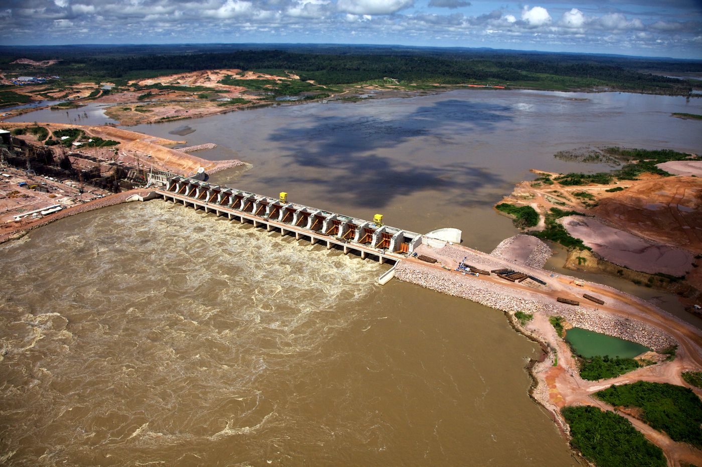
Looking at the Madeira, Marañon and Ucayali tributaries of the Amazon River, the researchers found some grim news. The Madeira River, which holds roughly half of total sediment transported from Bolivia and Peru and gives habitat to the most diverse fish population in the Amazon, has the highest DEVI values (higher than 80) and is extremely threatened byland use change, erosion, runoff pollution and trapped sediment. Two large dams have recently been erected on the river and already a 20% decrease in the average sediment concentration has been seen.
Meanwhile, the Marañon and Ucayali rivers aren’t doing so well themselves with DEVI scores of 72 and 61, respectively. The rivers have 104 and 47 dams planned or constructed dams and the scientists predict that 68- 80% of the upstream area will be subjected to the effects from the dams. Likely consequences include “modifying the rivers' dynamics, altering the creation of oxbow lakes and branches, decreasing floods and floodplain sediment storage, and putting thousands of species of birds, fish and trees at risk,” writes Phys.
The study is meant to stress the influences that these dams will make not only on the Amazon basin, but stretching even further. "The dimension of the impacts can be not only regional, but also on an interhemispheric scale," Latrubesse said. "If all the planned dams in the basin are constructed, their cumulative effect will trigger a change in sediment flowing into the Atlantic Ocean that may hinder the regional climate."
Sources: BBC, Phys, Nature