Imagine a model twice the size of a basketball court, filled with twists and turns and peaks and valleys. The size of it makes it hard to believe its classification as just a model, but indeed, this ginormous replica must cover such a large space because it represents the second-longest river in the United States: the Mississippi.
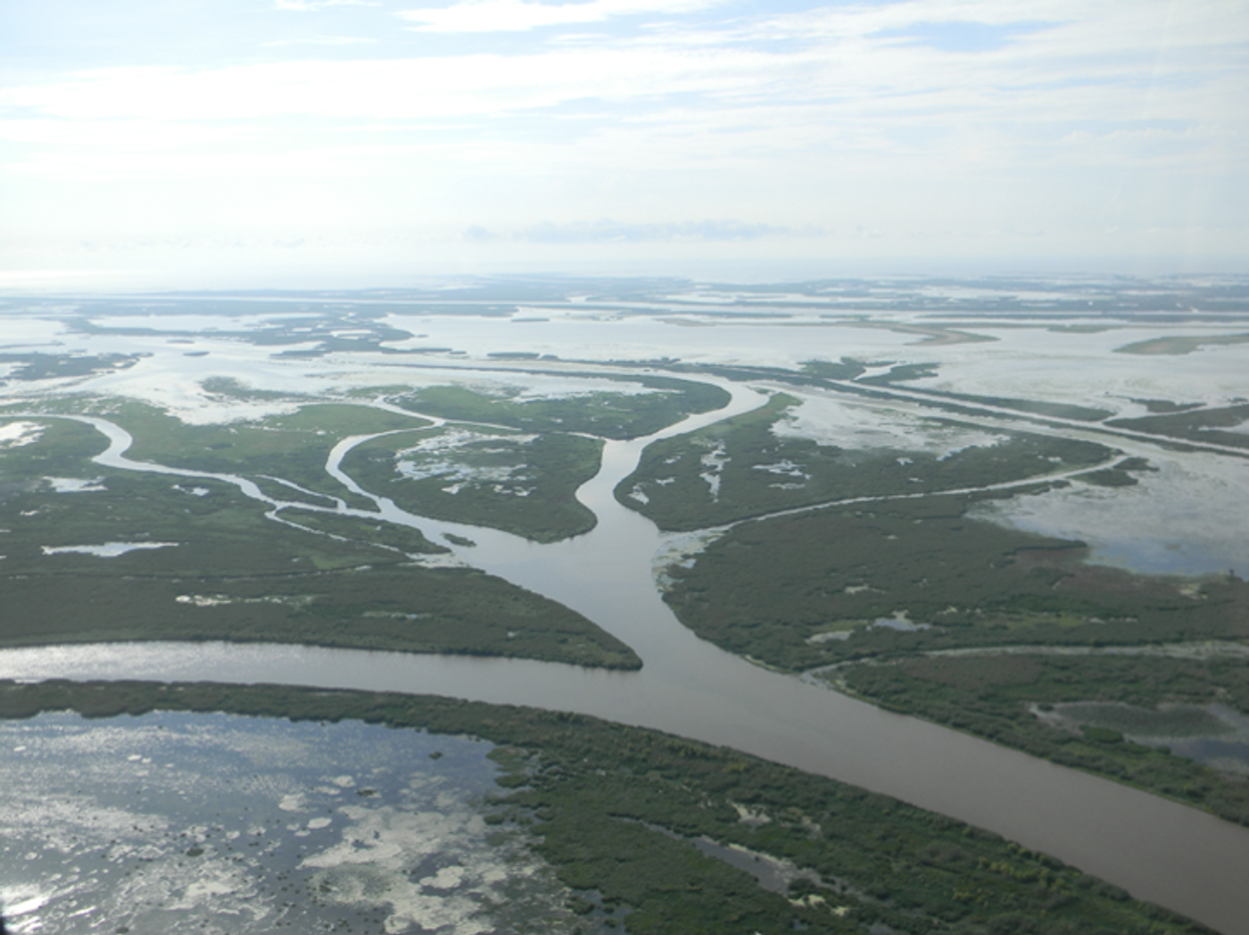
So, what rendered such a project necessary? Recent concerns about the Mississippi delta and coastal erosion have been on the minds of Louisiana State University scientists. Following representative Rudy Simoneaux from Louisiana’s coastal protection and restoration authority, Louisiana has lost roughly 2,000 square miles of coastline since the 1930s. As a result of this, there are various efforts to restore the coast. And in an attempt to accurately predict how coastal restoration measures will impact tributaries, marshlands, and wetlands along the river’s length, LSU’s Center for River Studies came up with the idea of the $4 million, 10,800 square-foot “Lower Mississippi River Physical Model.”
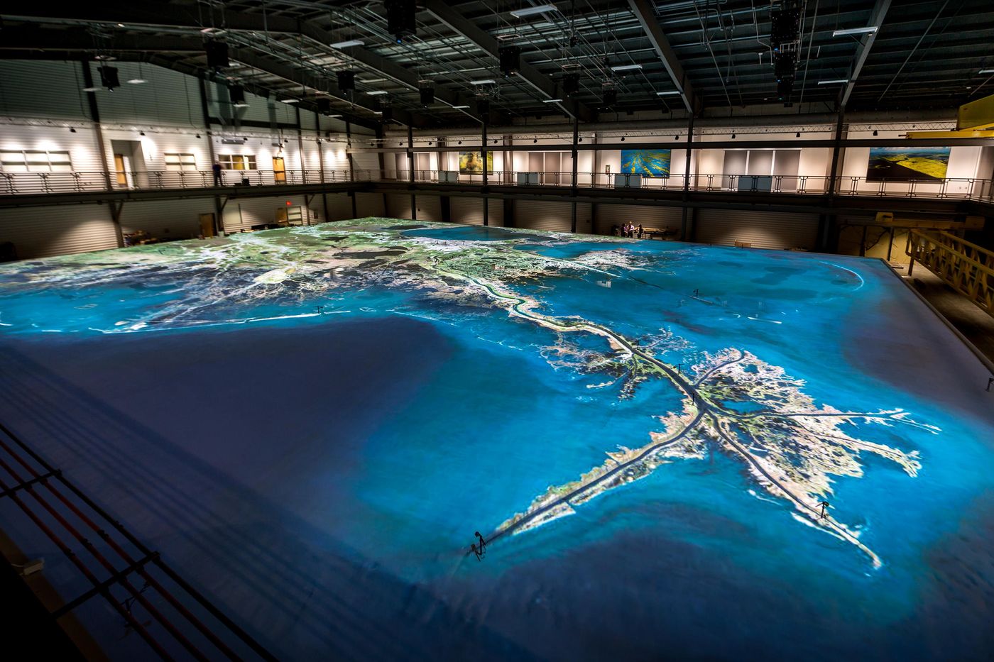
“What you do in one place has an impact on another,” said leader of the project Professor Clint Willson, “and so the idea of looking at larger-scale impacts or larger-scale processes is critical to looking at what the potential impacts are or the unintended consequences of projects, and so a model of this scale allows you to do that.”
By potential impacts and unintended consequences of projects, Willson is referring to several plans that aim to address the coastal erosion that has increased rapidly around the river delta in recent years due to sea level rise. One such plan, explains The Guardian, proposes “diverting nutrient-rich river water from the Mississippi into marshes and wetlands” with the intention of giving a lifeline to those ecosystems whose equilibrium has been thrown off from the excess of salt water. But before commencing with this plan, scientists want to be sure of the possible outcomes. That’s where the replica comes in.
“We can also model or simulate the transport or the movement of the Mississippi river sand down the river, and we can do all that in roughly one hour to replicate one year on the river.” In all, the model hopes to help answer some of the complexities that the Mississippi river system encompasses, such as how diverting a certain part of the river will impact its tributaries, wetlands, or levies.
Sources: The Guardian, NBC Bay Area, WWL