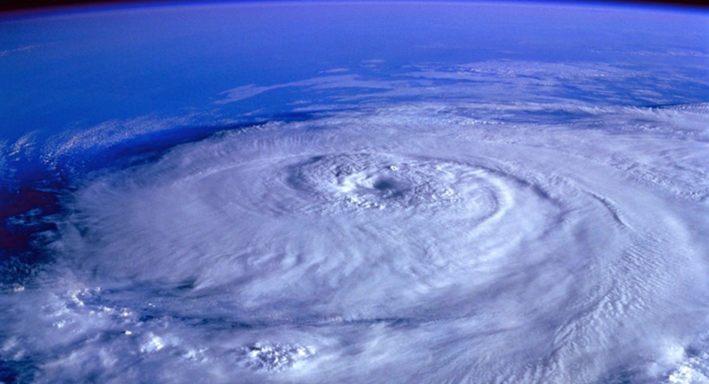
When a major storm hits, people can prepare for it in the best ways with advance notice. But sometimes predictions fail to anticipate how strong a storm will be. Some hurricanes can intensify very rapidly, which is when winds speeds in a hurricane increase by 35 miles per hour (mph/56kph) or more in under 24 hours, and come on as a major surprise. It seems like rapidly intensifying hurricanes have been getting more common, and they are difficult to predict. Some of these powerful hurricanes do a tremendous amount of damage, and areas that are impacted have little time to prepare. Hurricane Otis, which recently struck Acapulco, is an example of such a hurricane. Hurricane Otis wasn't expected to be a major storm, but its wind speeds increased by 110 mph in only 24 hours, to reach the highest strength of hurricane - a category 5, before it slammed into the populous city. As of October 30. 2023, the death toll from the storm was 45.
There are a variety of factors that can influence the intensification process in a tropical storm as it becomes a hurricane. Some relate to the environment around the tropical storm, such as complimentary flow, in which the winds around a tropical storm are moving in the same direction and boost the speed of the winds in the center. Another factor is how well the hurricane can increase spin, like a figure skater who pulls their arms inward so they will spin faster.
A new study has proposed that there are two primary ways that hurricanes can rapidly intensify, and they are totally different. This can help explain why these storms are so difficult to predict. The findings have been reported in the Monthly Weather Review, and they might improve storm modeling and forecasting.
"Trying to find the holy grail behind rapid intensification is the wrong approach because there isn't just one holy grail," said first study author Falko Judt, of the National Science Foundation's (NSF) National Center for Atmospheric Research (NCAR) . "There are at least two different modes or flavors of rapid intensification, and each one has a different set of conditions that must be met in order for the storm to strengthen so quickly."
Environmental conditions like low wind shear and warm waters can fuel a tropical storm, and this is a way that some of the most destructive storms in recorded history have formed, like Hurricane Katrina.
A previously unappreciated mode of intensification has now been identified. Unlike the other process that creates powerful, destructive winds in the storm's center, this mode generates major thunderstorms distant from the center of the storm. These thunderstorms lead to a reorganization of the storm that changes the circulation and causes the storm to quickly intensify and attain category 1 or 2 intensity within a few hours. This mode is stealthier, because these storms are often accompanied by unfavorable environmental conditions like high wind shear.
"Those storms are not as memorable and they're not as significant," noted Judt. "But forecasters need to be aware that even a storm that's strongly sheared and asymmetric can undergo a mode of rapid intensification."
Favorable environmental conditions that can produce category 4 or 5 hurricanes from a tropical storm were referred to as marathons. In these situations, the storm intensifies symmetrically as its primary vortex amplifies. The other amplification mode was called a sprint, because while these storms rapidly intensify, they don't usually last as long and peak around category 1 or 2. These scenarios may also exist at opposite ends of a spectrum, with individual storms falling somewhere along a range of modes.
The study authors suggested that Hurricane Otis was like a fast marathon; it intensified symmetrically, but unusually quickly.
Experienced research scientist and technical expert with authorships on over 30 peer-reviewed publications, traveler to over 70 countries, published photographer and internationally-exhibited painter, volunteer trained in disaster-response, CPR and DV counseling.