A growing fleet of satellites is taking flight with an Earth-friendly purpose: to locate leaks of methane, carbon dioxide (CO2) and other gases around the planet. The space institutes of several nations, including NASA, as well as private companies, are developing satellites to provide more timely and accurate data on these greenhouse gas emissions, which are linked to global warming. As John Fialka of E&E News reported, many key figures in these projects envision the development of a coherent and accessible global satellite emission data resource in the next decade or so.
“The days are coming when we will have satellites in the sky that can monitor any facility on this planet,” Rob Jackson, head of Stanford University’s Earth system science department, said. While satellites have been used to create many climate models, the focus on emission tracking is an emerging and quickly-growing field.
TROPOMI and GeoCarb
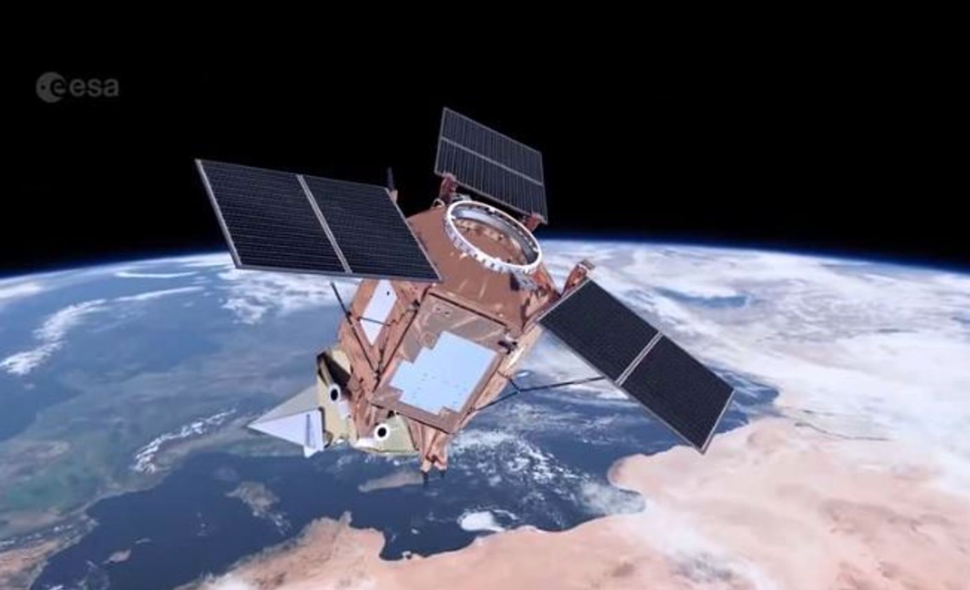
The TROPOspheric Monitoring Instrument (TROPOMI), the satellite instrument on the Copernicus Sentinel-5 Precursor satellite, was developed mainly by the Netherlands Institute for Space Research and was launched by the European Space Agency (ESA) in late 2017. TROPOMI has been sensing and mapping CO2, methane, carbon monoxide, nitrogen oxides and aerosols around the world. It was created to track the planet’s daily emissions and provide highly detailed imagery. TROPOMI can focus down to 1 square mile.
In the early 2020s, NASA plans to launch the Geostationary Carbon Observatory (GeoCarb), which will have a geostationary orbit and focus on the Americas. The goal will be for it to take up to 10 million measurements every day. It will seek to qualify methane emissions more accurately, which are caused mainly by fossil fuel production, along with the secondary source of agriculture and thirdly, forest fires. Along with the costly and dangerous effects of methane emissions on the climate, NASA conveys that leaks cost the U.S. industries related to gas production billions annually.
Claire and CubeSats
GHGSaT out of Montreal and Bluefield Tech out of Palo Alto, California, are also getting in on the satellite-emission-data game. GHGSaT launched a satellite called Claire in 2016 (named after an employee’s family member), which has small and lightweight sensors. Claire has been using TROPOMI data and has improved on its focus abilities – it can zoom in on a space as little as 164 square feet. GHGSaT partnered with the Canadian Space Agency to achieve this feat and hopes it can help companies quickly pinpoint gas leaks, saving them money. GHGSaT has an industrial concentration, but CEO Stephane Germain said he hopes in the future everyone (including government entities) will share and use the same wealth of emissions data.
Bluefield is making small satellites intended to help a variety of interested parties measure greenhouse gases, including oil and gas businesses and their investors, environmental and governmental organizations, insurance companies and agricultural operations, among others. CEO Yotam Ariel thinks the satellites the Bluefield team makes can help companies “keep an eye on their infrastructure” and react quickly to identified leaks. He thinks a global private satellite data industry will evolve within the decade.
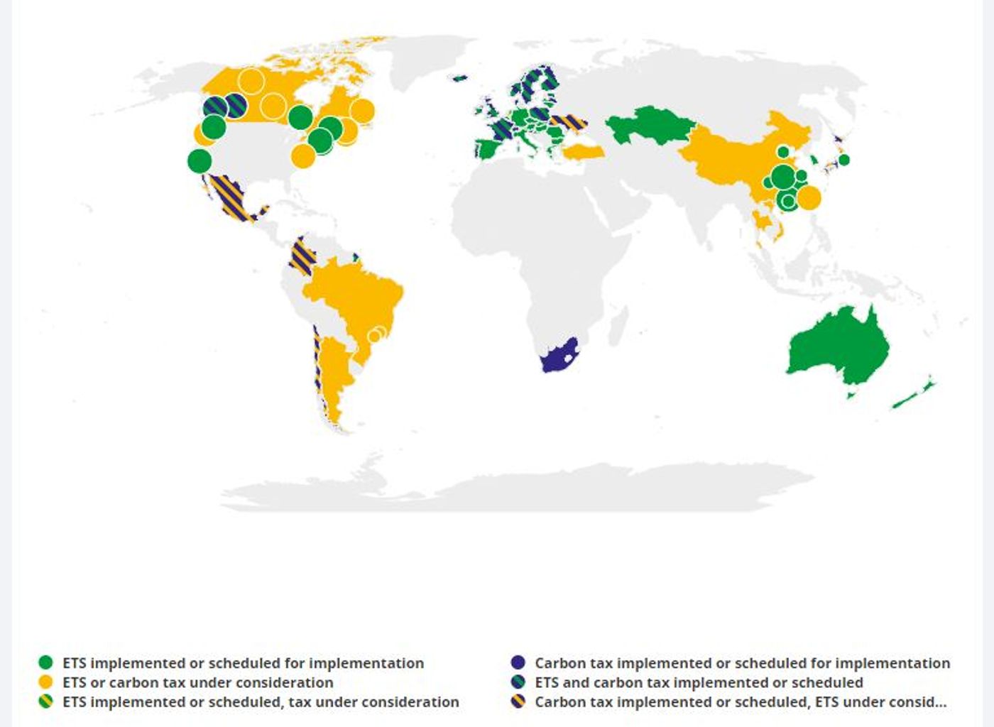
A key example of how the satellite emission data can be put to use is in service of carbon pricing initiatives. In these programs, like the one in California, companies are typically permitted a set level of emissions. They can usually sell off their given permits if their emissions are below the bar or will be required to buy additional ones if their outputs are too high. According to the World Bank’s 2017 data, the value of global carbon pricing initiatives is about $52 billion. The current total number of carbon pricing initiatives or emissions trading systems (ETS) that have been implemented or scheduled is 47, as mapped below.