California's Central Valley is a vital agricultural region. The San Joaquin Valley sits in its southern portion, and is the most productive agricultural area in the world. However, this place is also very dry, receiving an average of only 10 inches of rain every year. In particularly dry years, rainfall has been as low as three inches. It may seem strange that this arid place was once the site of a lake so large, it was the biggest body of water in the United States west of the Mississippi River. Known as Tulare lake, or Pa'ashi, this lake was over 100 miles long and 30 miles wide until the late 19th century. Irrigation systems installed by people made this lake dry up after that. But now, after massive rainfalls from atmospheric rivers in California, this lake is reemerging.
Snowmelt from the Sierra Nevada mountains was the primary source of water that fed Tulare Lake, known as Pa'ashi by the local Tachi Yokut tribe, noted Vivian Underhill, PhD. No natural outlet for this runoff exists, so it accumulated as a lake.
The disappearance started around the late 1850s, Underhill explained, driven by "the state of California's desire to take public land and put it into private ownership." This so-called public land was also "historically indigenous."
State officials "really wanted to get [land] into private hands so that indigenous land claims that were ongoing at that time would be rendered moot by the time they went through the courts." This procedure often went along with land drainage to create more land that could be used for farming. It also created an incentive for people to drain the land and put it to use. "It was a deeply settler colonial project," added Underhill.
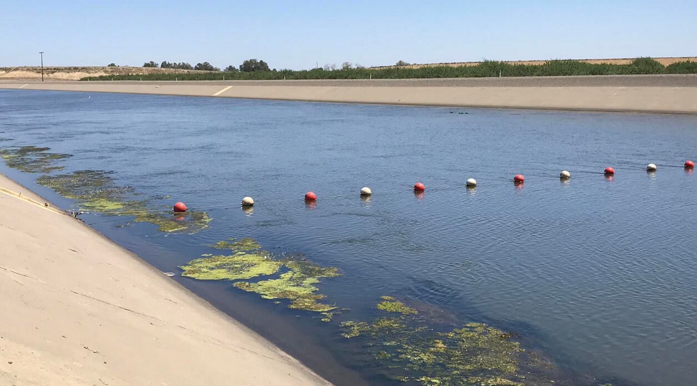
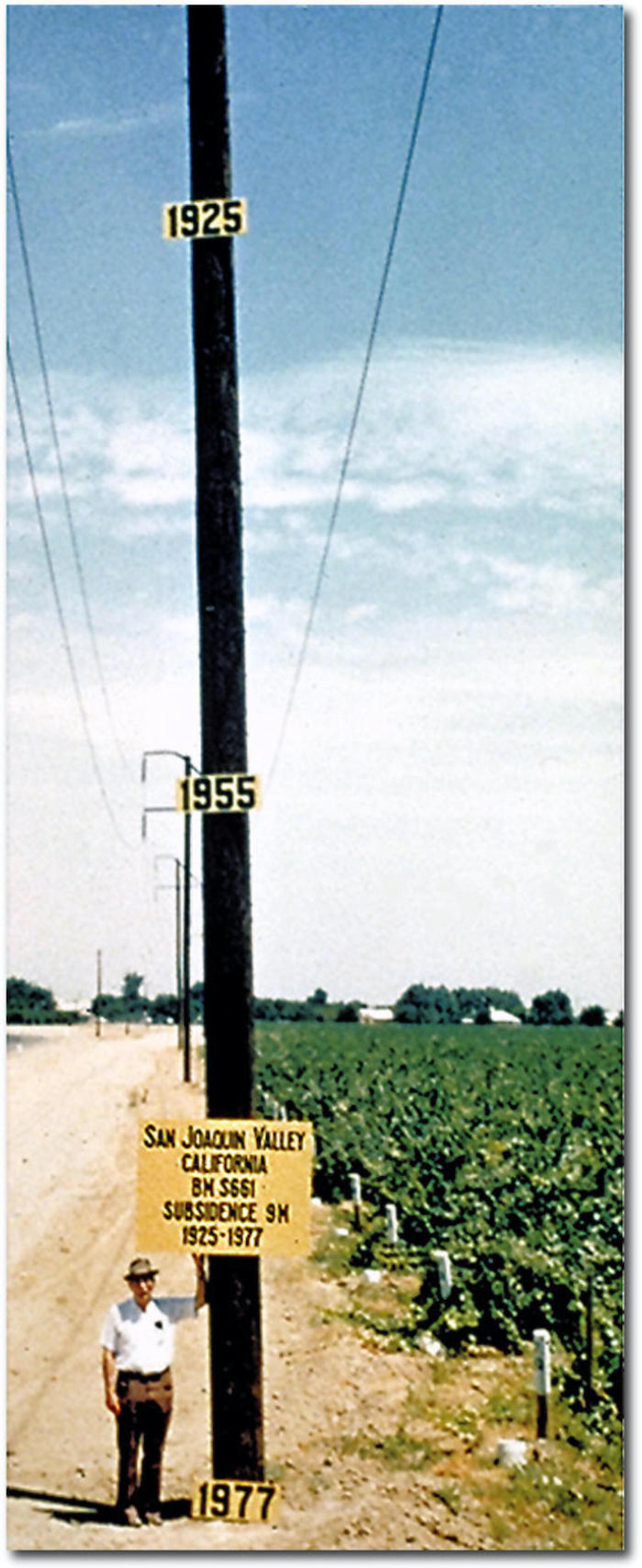
The water of Tulare lake was used for irrigating local fields, and the first total disappearance of the lake happened around 1890. Hundreds of canals now cross the area, which moved the lake's water into fields. All of that irrigigation also caused the land to sink, as shown dramatically in the photo above.
The total inundation of precipitation that occurred in California in 2023, dropped enormous amounts of snow in the Sierras. Once that snow rapidly melted in the summer heat, it brought the lake back. Some bird and wildlife species are already beginning to return to the area.
Underhill added that while there has been loss and devastation because of the heavy precipitation in California, there has also been a resurgence, which can be seen at this lake.
Already, people are moving to drain the lake and use its waters. While the lake has briefly reappeared before, human activity has rapidly diminished it again. Underhill expects that it now might last for another couple of years before it's gone again, unless there are new atmospheric river events that continue to replenish the lake and snowpack. Floods are also expected to increase in our changing climate, so predictions about timelines are difficult to make.
Experienced research scientist and technical expert with authorships on over 30 peer-reviewed publications, traveler to over 70 countries, published photographer and internationally-exhibited painter, volunteer trained in disaster-response, CPR and DV counseling.